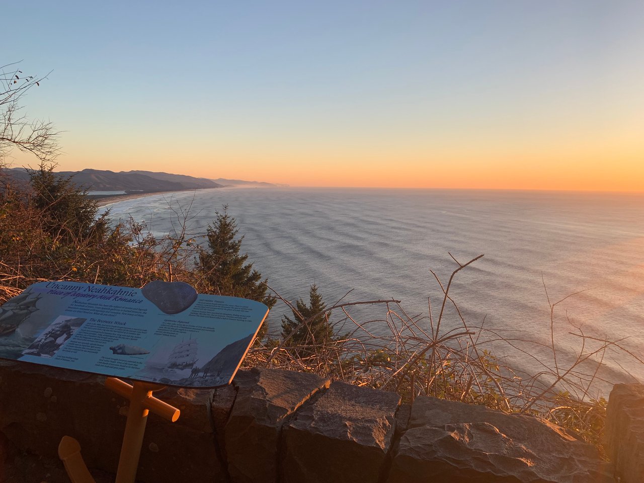
Neahkahnie Mountain has offers some of the most dramatic views on the Oregon Coast.
August 20, 2026
August 20, 2026
Stand at Necarney Creek on a summer morning and you will see hikers doing something no trail map tells them to do. They stop at the edge of the water, look for the flattest log, and step across one at a time. There used to be a suspension bridge here, built in 1990, that carried the Oregon Coast Trail from the rainforest side of Oswald West State Park to Short Sand Beach without anyone getting their boots wet. A December storm knocked it down in 2022, and the improvised log crossing has been the actual, load-bearing infrastructure ever since.
That gap in the trail is the reason this piece exists. If you have lived around Neahkahnie for a while, you already know the mountain, the beach, the switchbacks. What has changed underneath that familiarity is less obvious: the hike itself has been rerouted twice in six years, once by accident and once on purpose, and most of what gets published about it still describes a version of the trail that no longer exists in the form the writer imagined.
On December 27, 2022, several trees came down during a severe winter storm and struck the suspension bridge over Necarney Creek. Oregon State Parks spokesperson Chris Havel told KOIN that the trees dislodged a bridge anchor on at least one side and that the span was likely a total loss. Crews had to clear the surrounding blowdown before they could even assess the damage, let alone plan a repair.
That assessment appears to have gone nowhere fast. Oregon State Parks' own current page for Oswald West still lists the Necarney Creek span as removed, with no announced timeline for replacement. Meanwhile, some travel write-ups updated as recently as February 2026 continue to describe the suspension bridge as a standing feature of the trail, the same way it was described a decade ago. That mismatch, a park agency quietly acknowledging an indefinite closure while other content keeps citing the bridge as if it is still there, is the clearest evidence that the map most people are working from is out of date.
The workaround is not signed or maintained. It is folk knowledge, the kind you only pick up by going or by talking to someone who has. Cross at the beach, not at the old bridge site upstream. Pick your footing depending on the season. Oregon State Parks itself has recommended hikers wait for gentler summer conditions before attempting the creek on foot, which makes August a genuinely better month for this than February.
The other change is less dramatic but arguably more useful day to day. In 2020, Trailkeepers of Oregon and the Northwest Youth Corps finished a two mile forest connector now called the Neahkahnie Gap. Before that trail existed, hikers moving between Manzanita and the South Neahkahnie Mountain Trailhead had one option: walk the narrow shoulder of Highway 101. Now they don't have to.
The practical effect is that "hiking Neahkahnie" no longer describes a single outing. It describes at least three, and they are not interchangeable.
Starting point | What it connects to | Current condition (2026 reports) | Best for |
|---|---|---|---|
South Neahkahnie Mountain Trailhead, off Highway 101 | A shorter climb to the summit viewpoint, roughly 3.5 miles round trip | Recent reviewers describe overgrown sections and slippery rock near the top, manageable with good shoes | A half day out, families comfortable with a scramble at the end |
North Neahkahnie Mountain Trailhead, off Highway 101 near Manzanita | A longer, quieter approach with sweeping views of Nehalem Bay | Consistently reported as overgrown in 2026, with several reviewers recommending long pants and bug spray | Hikers who want solitude over convenience |
Neahkahnie Gap, accessed near Nehalem Road | The forest link between Manzanita and the South trailhead, replacing the old highway walk | Described as quiet with good upkeep, though views are limited along most of it | Anyone commuting between the beach town and the mountain who wants trees instead of traffic |
None of these three converge into one tidy loop unless you also factor in the missing bridge, which is why so much online advice still flattens Neahkahnie into a single generic "hike to the summit" recommendation. The mountain rewards knowing which door you are walking through, not just that a door exists.
Trail apps list Neahkahnie as open year round, and technically it is. But the honest answer for anyone deciding when to go is that August sits in the window Oregon State Parks itself flagged as the safer time to cross Necarney Creek. Reviewers logging hikes in May, June and July of this year describe the same recurring conditions: overgrown salmonberry and thimbleberry crowding the trail edges, muddy patches that never fully dry out under the tree canopy, and the log crossing at the creek as routine rather than remarkable. Winter storms bring down more trees and worse footing. If you have been putting off the summit because the last report you read sounded discouraging, the discouraging parts were mostly a winter problem.
Cape Falcon and the Elk Flats Trail, both inside the same park, offer a gentler alternative if the creek crossing or the summit scramble does not sound appealing on a given day. Cape Falcon in particular gets cited repeatedly for a good chance at spotting seals and pelicans from the headland, with an elevation gain modest enough for a wider range of hikers than the Neahkahnie summit routes demand.
Living somewhere means the ground underfoot keeps changing even when you are not actively using it. The mountain that anchors this part of the coast has spent the last several years quietly renegotiating how people move through it, and that renegotiation has mostly happened without an announcement. No press release accompanied the completion of the Neahkahnie Gap in 2020. No update went out when the state park's own materials continued to describe a bridge that had already washed away. The people who know the current version of the trail are the ones who walked it recently and paid attention, which is a decent working definition of what it means to actually live somewhere rather than just visit it.
That is also, not coincidentally, the same kind of attention this team brings to the rest of the neighborhood. Trail conditions change. So do septic rules, flood maps, and which streets flood first in a heavy December storm. The value of local knowledge is rarely in the big headline fact. It is in noticing when the map and the ground stop matching and being the one who mentions it.
After the hike, Manzanita is close enough for a reasonable reward. Manzanita Coffee Co. works if you want caffeine before the drive home, and San Dune Pub and Cloud and Leaf Bookstore both sit within an easy walk of downtown if you want to sit down for a while before deciding whether your legs are done for the day.
If you are thinking about property in this stretch of the coast, whether that means a weekend place near the trailhead or something further into town, Andrea Mace and the Mace Team spend as much time paying attention to details like a washed out bridge as they do to comparable sales, because both tell you something true about what living here actually involves. Schedule your concierge consultation when you are ready to talk specifics.

The Oregon Coast Town that Time Forgot
Cannon Beach Lifestyle
Cannon Beach Cottage Tour & Stormy Weather Arts Fest
Now, there's a new trail to discover called the Neahkahnie Gap.
More than 30 years later, I’m still here—and the Oregon Coast continues to shape the way I live, work and think about home.
Want to sell now or in the future? Let's start a conversation about how my services can be put to use to market and sell your home to a qualified buyer.